

- A gross income of $250,000 or more per annum in each of the previous two financial years; or
- Net assets of at least $2.5 million; and
- A verified Qualified Accountant’s certificate given no more than two (2) years ago confirming the Sophisticated Investor status. Please refer to the Corporations Act: Specifically Section 708(08) and Section s761G(7)
Fairbanks Gold District
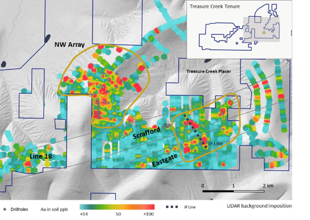
Treasure Creek
Treasure Creek is a large tenure package of 116 km2 surrounded by infrastructure located only 20 km from Fairbanks City.
There is evidence of gold from multiple sources:
- Placer mining production from creeks draining from claims
- Multiple large-scale soil anomalies with scale in excess of 1km
- Historical drilling with intersections of Fort Knox grade profile characteristics. These drill intercepts are open.
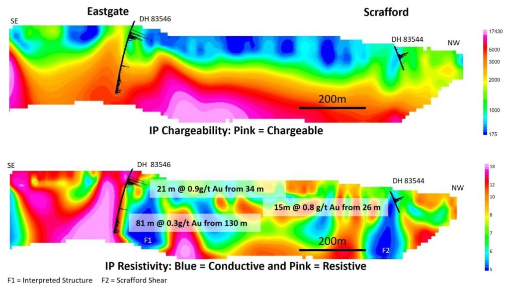
Two key target areas are Eastgate-Scrafford Zone and NW Array. Felix have defined multiple drill ready targets and consider there is evidence of near surface bulk tonnage gold systems.
At Eastgate-Scrafford, Felix undertook a Pole-Dipole IP Survey and identified several geophysical anomalies adjacent to known mineralisation indicating a potential large-scale gold mineralisation system.
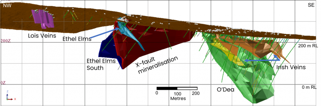
Grant-Ester
The historical Grant gold mine lies on 34 km2 tenure. Grant has four separate gold-bearing quartz veins, open to depth and open along strike.
The Inferred Mineral Resource estimate (JORC 2012) for Grant Mine of 5.8Mt @ 1.95 g/t Au for 364 koz gold (includes underground resource of 136 koz gold @ 6.2 g/t Au).
Felix has also established an Exploration Target (exclusive of the Mineral Resource) for the Grant Mine.
Felix is focussed on extensional drilling of identified high-grade gold zones and untested areas in the corridor. Selected significant intercepts include:
- 18m @ 11 g/t Au
- 6m @ 17 g/t Au
- 6m @ 13 g/t Au
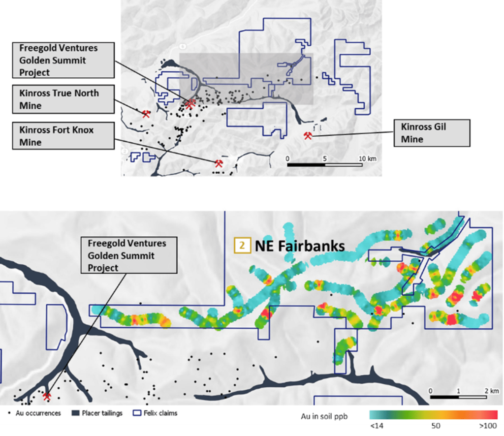
NE Fairbanks
NE Fairbanks comprises 146 km2 of tenure adjacent to extensive historical placers and within 10 km of Kinross’s Fort Knox and Gil gold operation and Freegold Ventures Golden Summit project.
Soil sampling carried out by Felix in 2021 identified broad gold-in-soil anomalies.
Felix Mineral Resources
View our updated Mineral Resource Statement